Pilgrims re-trace ancient route to Hastings Castle


This article contains affiliate links. We may earn a small commission on items purchased through this article, but that does not affect our editorial judgement.
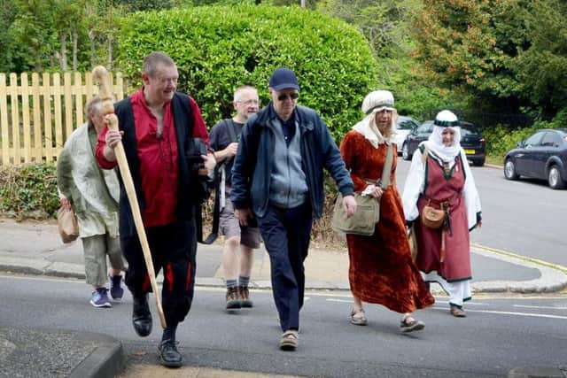
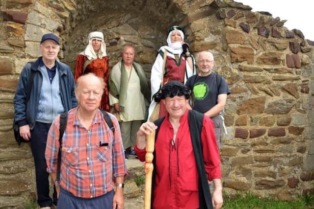
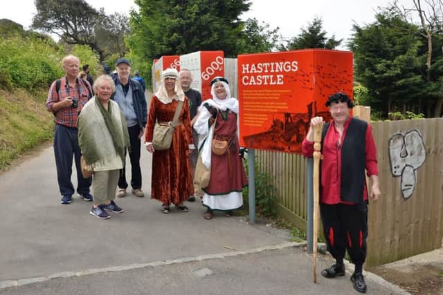
The walk saw people donning medieval garb to walk from St. Michael’s Place at White Rock then following a two mile walk up to the castle on the West Hill.
The Lord’s Prayer was recited in Anglo-Saxon, and people enjoyed a picnic in the castle grounds.
Advertisement
Hide AdAdvertisement
Hide AdSt Michael’s, attached to the church of St. Mary-in-the-Castle, was in existence and receiving pilgrims all year round, from before 1066.
A post-1066 charter says the canons had the duty to ring a bell for an hour or longer, to allow time for the pilgrims, who gathered each morning outside St. Michael’s Church, to walk from there, where Hastings town mostly was post-1066, to the Castle, in time for Matins.
The pilgrims came from anywhere in England, to stay overnight, post-1066, in the then town of Hastings, before setting out as a group to the Castle.
In the 11th century, Hastings had a fine natural harbour, extending up through the modern town centre as far as South Terrace (North side of Priory Meadow Shopping Centre). It also extended further south than the current coastline, as both White Rock and West Hill stuck out much further than they do now. The cliffs have been undercut by the sea, and suffered cliff falls; also in the early 19th century they were cut back, to make way for the seafront and houses.
Advertisement
Hide AdAdvertisement
Hide AdBones from St. Michael’s Church’s graveyard were disturbed when the coastguard station and cottages were built at St. Michael’s Place, so the church must have been very close.
The time the bell was tolled tells us that the walk from outside St. Michael’s up to the Castle took about an hour, or somewhat less; on the flat. This would be three miles. The modern definition of a league; but the old-fashioned definition was the distance you could cover in an hour. A 1765 estate plan of Priory Farm shows a track going up the west side of the valley, from Priory Farm (built on the foundations of the Augustinian Priory, ruins now under ESK) to the watermill which used to stand at the western end of Waterworks Road.
The building of the railway line and Hastings Station, plus town centre housing, mean that it is not now possible to walk along this part of what was almost certainly the original route going round the natural harbour of Hastings.
However, from Waterworks Road, the route still exists: Waterworks Road used to be a path known as ‘the Wapple’, meaning a path that you could get along on foot or horseback, but not with a cart or carriage. There is a clear connection between this path and the Castle, through the Castle’s ‘Wapple Gate’ - it is not currently known if this is the North Gate (the entrance in use today, and the original entrance), or some other outer defensive gate close to the Castle.
Advertisement
Hide AdAdvertisement
Hide AdDon’t miss out on all the latest breaking news where you live.
Here are four ways you can be sure you’ll be amongst the first to know what’s going on.
1 Make our website your homepage at www.hastingsobserver.co.uk
2 Like our Facebook page at www.facebook.com/hastingsobserver
3 Follow us on Twitter @HastingsObs
Advertisement
Hide AdAdvertisement
Hide Ad4 Register with us by clicking on ‘sign in’ (top right corner). You can then receive our daily newsletter AND add your point of view to stories that you read here.
And do share with your family and friends - so they don’t miss out!
The Hastings Observer - always the first with your local news.
Be part of it.